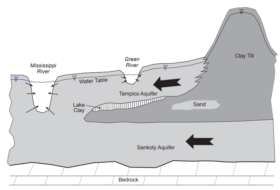
The Green River Lowlands in, Lee, Whiteside, Bureau and Henry counties, is a heavily irrigated portion of Illinois, comprised of the uppermost Tampico Aquifer and lowermost Sankoty Aquifer. These aquifers are separated by a clayey aquitard that becomes more extensive to the south of the Rock River.

Irrigation wells are predominantly finished in the deeper Sankoty Aquifer, which experienced its largest observed drawdown during the drought of 2012, in northwestern Bureau County. To monitor the impact of irrigation in the region (as well as the potential for groundwater flooding during rainy seasons), the ISWS currently has nine real-time monitoring stations in the region, with periodic hand-measurements at 30 other wells. For more information on the hydrogeology of the region, see ISWS Data/Case Study 2004-01.
The map below shows the location of the monitoring wells in the Green River Lowlands area.
→ Hover over a location, to view basic well information and the most recent depth to water measurement [LAST_AVAIL_DTW].
→ Click on a location, to zoom in and populate its hydrograph and detailed well information below.
→ Filter wells by aquifer, using the "AQUIFER FILTER" buttons.
→ Change the basemap, with the layer selection tool in the upper-right hand corner of the map.